By Spc. Chandler CoatsAugust 26, 2022
JOINT BASE LEWIS-MCCHORD, Wash.-- The Program Executive
Office for Ground Combat Systems (PEO GCS) hosted a two-day demonstration event
at JBLM on Wednesday and Thursday highlighting state-of-the-art communications
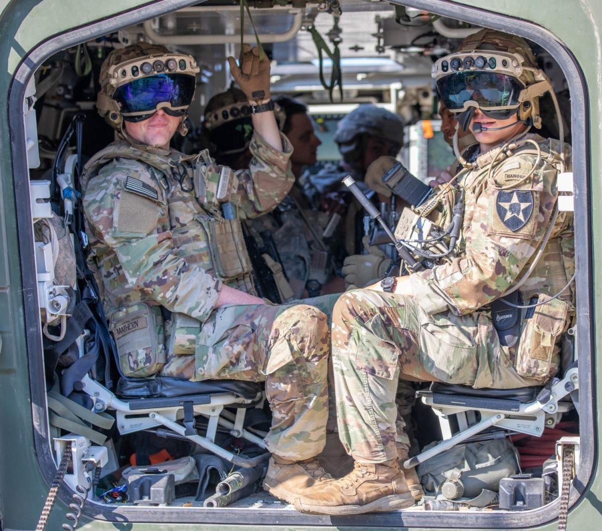
and visual augmentation technology integrated into U.S. Army Stryker armored
vehicles as well as soldiers’ individual combat gear.
The event was part of the ongoing development of the
Integrated Visual Augmentation System (IVAS), based on Microsoft’s existing
HoloLens 2 technology that has been tested by soldiers since 2019. The IVAS system
is an augmented reality goggle that provides soldiers with real-time
battlefield information such as enemy and friendly locations, navigation
information, and high-resolution night and thermal vision.
IVAS’ capability is being significantly expanded with the
latest iteration, according to David Morris, Ph.D. and Lead Network Engineer
for MITRE Corporation’s Army Platforms Division.
“The major new technologies we’re experimenting with today
are the Tactical Scalable MANET waveform, which is bringing data down to the
forward tactical edge to the dismounted soldiers and to the vehicles, and
connecting those systems together so that everybody has awareness of where the
others are,” Morris said. “You can send messages, lay down graphic overlays,
mission data, etc., so that you’ve got better capability that previously was
only available up at the command post.”
High-quality camera systems were also integrated into the
Strykers and linked with IVAS, said Morris.
“The other piece we’re adding is 360-degree situational
awareness,” said Morris. “We’ve added a variety of cameras to supplement the
existing vehicle cameras. So instead of just having the gun camera and the
relatively small forward and reverse cameras, now we've got high-end cameras
all the way around the vehicle with both day and night vision. The soldiers
wearing the new IVAS technology are able to use those cameras and access them
while they're en route to mission. Instead of staring at a blank steel wall,
they can keep up with what's going on around the vehicle. They can also switch
to a tactical map mode so they can see what's going on around their broader
mission area."
The culminating event of the demonstration involved a
platoon task force of five Stryker vehicles operated by 3rd Platoon, Blackhorse
Company of 2-3 Infantry Regiment, 1-2 Stryker Brigade Combat Team carrying
infantry soldiers on a movement-to-contact and urban raid mission to seize and
clear a building in Leschi Town, a training range at JBLM. An operation of this
size previously would have been conducted with a larger company-sized force,
but the new expansion of IVAS increases capability such that one platoon can
carry out the mission, according to Phillip Landan, Assistant Program Manager
and Product Lead for Ground Combat Product Integration.
Putting new tech into soldiers’ hands during the product
development stage and conducting simulated combat exercises like these enables
developers to reduce cost, schedule, and performance risks, validate prototype
installation and interoperability, and capture soldier feedback to improve
future designs, according to PEO GCS. Soldiers were given several surveys to
fill out following each training exercise along with conducting after-action
review meetings, giving direct feedback to the various offices and companies
who are developing the systems so that their input can be used to improve the
final product.
The increased capability was generally well-received by the
soldiers testing out IVAS, who have been training on it for the past two weeks
leading up to the demonstration.
“When all doors and hatches in the Stryker are closed, I can
see 360 degrees around my vehicle to check for IEDs, check where my other
vehicles are and check their movement, and all of that has been a huge asset to
us these last two weeks,” said Sgt. 1st Class Kyle Williams, third platoon
leader for Blackhorse Company. “The situational awareness that I'm able to gain
at a leader level from being able to see the icons for where all my [soldiers]
are means I can do route planning, I can do mission planning, I can publish
graphical overlays, I can navigate with literally a turn-by-turn navigation
feature, and I can send messages back and forth to the members of the platoon.”
This means that every soldier can better contribute to
accomplishing the mission, said Williams.
“It greatly enhances our ability to operate."
(U.S. Army news article by Spc. Chandler Coats, 5th Mobile
Public Affairs Detachment)
Comments
Post a Comment